July 8, 2014: Route 66 – Holbrook to Seligman, Arizona
Today’s Map
Below is an interactive map of our trip, tracked using my Trimble Outdoors Navigator iPhone app. You can zoom in, or click the link below for a bigger, fullscreen map.
Feel free to browse and refer to the map for details about where we traveled, the photos were taken, etc.
Even though we had a perfectly acceptable stay at the Magnuson, it would have been nice to sleep in a Wigwam (we have at the Cave City, KY location). But here’s a morning photo on our way out of town.

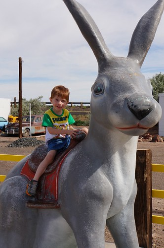
Next, we stopped at the Jack Rabbit Trading Post. Glad we went and checked the door, because it looked closed, it seemed dark inside and there were no cars visible. But happily, they were open. Sadly, though, they no longer sold that cloyingly sweet cider we enjoyed on our honeymoon. We picked up a few souvenirs, including a HERE IT IS shirt for our grandson.


And here he is, posing on the Jack Rabbit! A rite of passage for all good Route 66 roadies.
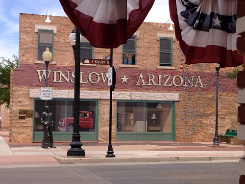
Continuing to motor west, our next stop was Winslow, Arizona.

There is a 9/11 Memorial on the east end of Winslow on 66, which contains pieces from the World Trade Center.

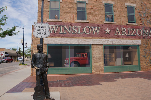
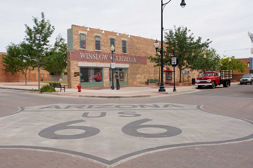
We went over to Standin’ on the Corner Park, which has a mural, statue, and Flatbed Ford, all depicting a scene from The Eagles’ song “Take It Easy.”
There’s a man with a guitar standing on the corner, and the reflection in the window of a girl in a Flatbed Ford. I decided to take it easy and sip a Route 66 root beer. Very peaceful and relaxing.
Closeup of the statue…I still think he looks like Jackson Browne, despite the fact that there is no “official” word on who this is (I asked)!

I browsed in two of the shops there and picked up some t-shirts and postcards, while Pat took our grandson for a walk (a 3 year old and breakables is not a good combination!!).
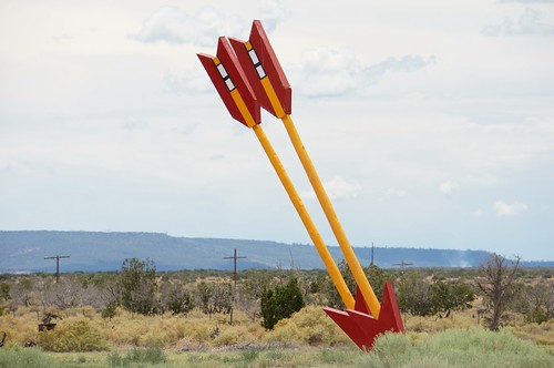
Continuing west, we stopped for a photo at the old Twin Arrows Trading Post. It was barricaded and not as easily accessible as it used to be. There was also a casino nearby, of course, called the Twin Arrows Casino.

This old bridge is located on Route 66 at the Winona exit (exit 211 from I-40).

Heading toward Flagstaff.

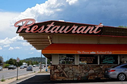
In Flagstaff, is this former Howard Johnson’s Restaurant (the hotel is still that brand), now the Crown Railroad Cafe.
Western Hills Motel sign

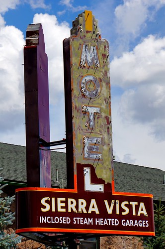
Sierra Vista Motel sign
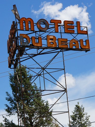
Old scaffold style signs in Flagstaff – Downtowner Motel and Motel DuBeau

We stopped in Flagstaff for a while to walk around and take photos of various Easy Rider filming locations, from the opening credits, which was filmed in part along Route 66 in Flagstaff. Click here for my post on Easy Rider Filming Locations to see more photos from Flagstaff along with screen shots from Easy Rider.
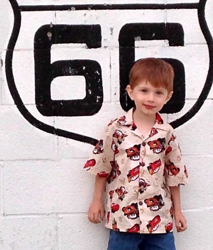
We stopped at the 66 Visitors Center and picked up a couple of Route 66 / Cars shirts for our grandson. One was a 66 t-shirt and the other was a really cute hand made Hawaiian type shirt made from Cars fabric with a map and Cars characters Mater and Lightning McQueen.
There was a bakery called Sugar Mamas that we wanted to visit, but it had already closed.
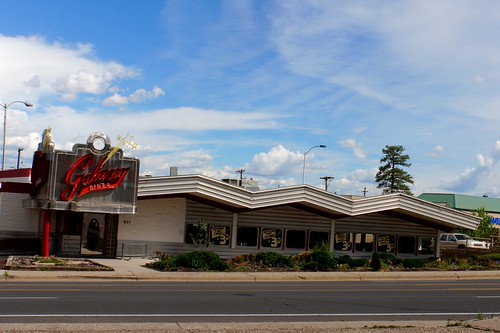
The Galaxy Diner is on 66 on the west side of town.
West of Flagstaff, Route 66 takes you on a scenic drive through the Kaibab National Forest. This is another location that was well-depicted in the Pixar film Cars, as Sally & Lightning take a drive through the forest (see video below the photo).
We told our grandson this was where Lightning and Sally went for a drive too!
Next, we arrived in Williams, a really nice Route 66 town with alot of great shops and restaurants. Again, we no longer buy alot of knick knacks, since we’re not in “acquisition” mode, but rather on a long, slow path to decluttering and eliminating stuff for a future of “fulltiming” in an RV someday, but that’s another story. We do buy a few things that we can use like t-shirts, coffee mugs, tote bags, etc. So I bought a cool Route 66 ceramic coffee mug at Cruisers and a couple small other things.

I was disappointed to see the Route 66 Inn closed. I stayed here during my first trip on Route 66 in August 2000.

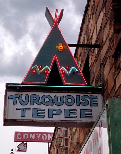
Turquoise Tepee
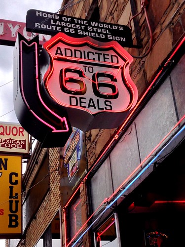
Addicted to Deals
Rod’s Steak House

We stopped to get some ice cream at Twisters Soda Fountain…the chocolate met with our grandson’s approval! Here he is wearing the Cars shirt we had bought him in Flagstaff.

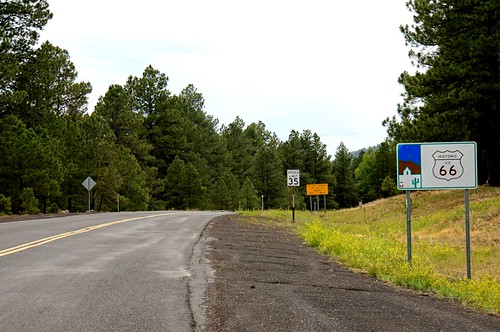
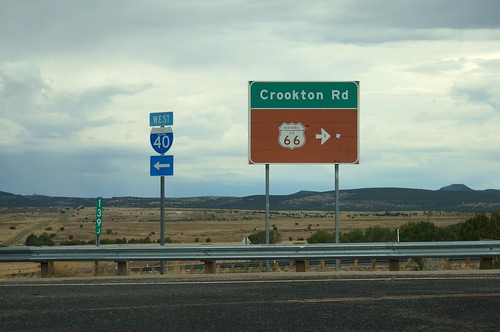
We managed to walk around Williams without any rainfall, which was looming. Moving west, we took the Crookton Road exit, which leads travelers onto a beautiful stretch of Route 66 away from the Interstate, and through Ash Fork, Seligman, Hackberry, Truxton, and on into Kingman.
Here are two photos at the Crookton Road exit.

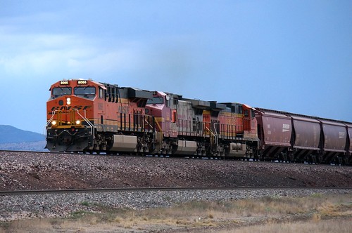
Near Seligman, another BNSF train was approaching!
Next, we arrived in Seligman as it was nearing dusk; however, as we had never stayed in Kingman, that was our intended destination for this evening.
Looking west on 66 in Seligman.

The Copper Cart

Fillmore from Cars!

Historic Route 66 Motel on the west side of Seligman

The Supai Motel

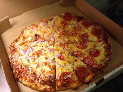
We needed to get gas, so we stopped on the west side of Seligman. Once we did, we realized we really didn’t want to continue for this evening. It was getting dark, and we wouldn’t see much between here and Kingman. We decided to stay at the Stagecoach 66 Motel, where we’d stayed on our honeymoon. Double bonus, there was a restaurant / bar on the premises, so we could get some takeout and eat in our room (we would have eaten at the Snow Cap, but it was already closed by the time we arrived in town).

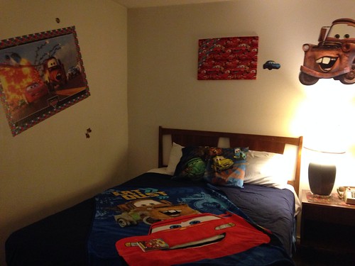
They had vacancy, and Pat even managed a surprise…a Cars-themed room. Jameson was very excited to see all of the decor with Mater, Lightning McQueen, and other Cars characters, just like his room at home. He was literally bouncing all over the place in excitement.
As Pat went over to the bar & restaurant to get a pizza, Jameson and I had a nice walk all around the grounds of the motel (about 5 laps, no less). It was a nice, peaceful time – I’m not sure what’s in the air in Seligman that calmed my grandson down, but it was just about the most quiet time I’d had with him so far during the trip (and in retrospect it would turn out to be the most quiet time of the entire trip…).
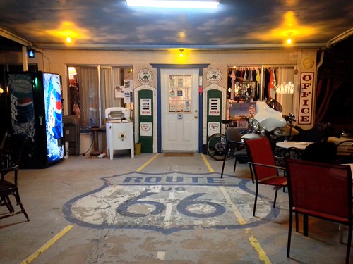
The office area of the motel.
Dinner!
Then it was time for some shuteye and the nightly ritual of trying to get our grandson to calm down and go to sleep. Mercifully, he fell asleep fairly easily today!
Until tomorrow…
Slideshow of All Photos (July 8, 2014)
Below is a slideshow of all of the photos from this portion of the trip.
Click any photo to stop the slideshow and view the photos on my Flickr site. If you are on an iOS device and do not see the slideshow below, click here to view the set on Flickr.
Hope you enjoyed the ride!
Pat & Jennifer
