November 27, 2008: Route 66 (Day 1)
We woke up this morning intending to head south to Georgia. After a last check of the weather we noticed the forecast had worsened. The chance for rain increased significantly, and since I had a specific purpose for this trip mostly involving outdoor photography, it was not something I wanted to do in the rain. We struggled between wanting to go and whether or not to trust the forecast. We could go somewhere else with a better forecast or not go at all. Pat hinted at going west on 66 since we hadn’t done that in a while. He’s very indecisive, as readers of his blog know from his recent post. We didn’t have enough time for him to put up a poll on his blog to decide where to go, so he let Amber decide. He wrote 3 options on bottle caps: go to Georgia as planned, take Route 66 west as far as we could go, or stay home, and geocache locally. Whichever cap she picked was what we’d do, and she picked geocaching.
Since we now had no time constraints, I watched the Macy’s Thanksgiving Day Parade with Amber & plotted a couple of Indiana cache routes with my new DeLorme Topo 7 software. I also played with transferring waypoints to my new GPS, a DeLorme PN-40. So once I did that and the parade ended, I asked Pat about heading out. Then Pat says, “Wanna go to Atlanta?” So much for the written in stone bottle cap selection. I’m game to try it, so I finished packing, said goodbye to Amber and off we went.
We figured by this late hour, we’d have to superslab most of the trip, so we could get to our destination at a reasonable hour the next day. It was especially important, since the forecast called for some showers building late Friday and Saturday was looking like a total washout. As we headed south on I-65, I started feeling some negative road karma, but while I didn’t want to go home, I really didn’t want to deal with rain. I also didn’t feel like having to superslab the trip in a hurry, and I thought that by the time we’d get to Atlanta, I’d only have a small window of “cloudy” weather with rain closing in. At best, I’d have to rush around taking my photographs before rain set in, and at worst it would be raining. So I said to Pat, “Let’s go on 66 instead!” So we cut across town to I-70 and started our journey west.
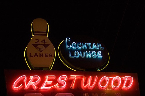
After we crossed into Illinois, we took US 40, only taking the evil-I into St. Louis. 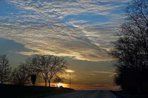 We exited at Hampton Road and took 66 partly through town. By now, Ted Drewes is in “Christmas tree selling” mode. We passed by Crestwood Bowl, of which I haven’t had the chance to take a photo until now.
On Chippewa, there was a Shell station with unleaded gas for 1.33! We took the Interstate from the west side of town to Eureka, then took 66 until Stanton. At that point, we got back onto the Interstate. We thought we might make it as far as Rolla where there are plenty of lodging choices. We passed by Finns Motel in St. James and decided to check it out. The price was reasonable the room was clean and they had WiFi so we opted to stay.
We didn’t get much sleep the night before and I was fairly exhausted so I fell asleep right away.
Slideshow of All Photos
For more details about a particular photo, click on it in the slideshow and it will open in my Flickr site.
[flickrslideshow acct_name=”roadtripmemories” id=”72157610721213953″ width=”500″]